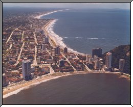
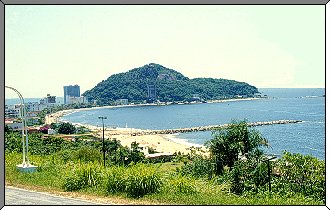
 View of Praia Mansa and Praia Brava - 1986 |
PRAIA MANSA
|
PRAIA MANSA |
![]()
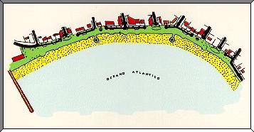
| Praia Mansa, about 1,000 meters long, is located at the northern part of the mouth of Guaratuba Bay. Facing SSE, it is exposed to the worst storm winds that come from the South. |
| The
maximal tidal range at the site is 2.2 meters, and on
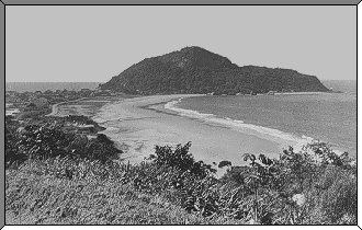
storm days the waves get up to 3.0 meters high. In 1958, the backshore of Praia Mansa was over 100 meters wide. |
 |
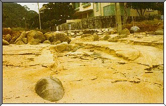 |
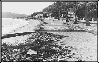
With the increasing number of buildings and street paving, the first signs of beach erosion began to appear, mainly at the ends of the pluvial water ducts. |
| With the exception of the construction of a small stone seawall, no other measures of protection had been used. Although the seawall provided better protection for streets and buildings, it increased the speed of beach erosion. Beach erosion was then increased by the combined action of pluvial and sea erosion: the pluvial erosion lowering the beach profile and thus allowing the waves to come ever nearer to the houses. |
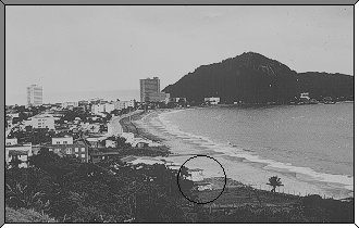
| In 1968 the backshore was reduced to 60
meters. Without care, the rate of erosion was increasing, even causing the destruction of part of the house which we can see at the bottom of the picture to the right. |
 |
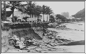
| Conditions became critical in 1977, when the sea destroyed part of Atlantica Ave. (today Agilio Leao de Macedo Ave.) and even began to threaten the buildings. |
 |
 |
| That same
year, the government of the State of Parana (through
EMOPAR - Empresa de Obras Publicas do Parana -
"Parana Public Works Enterprise") contracted LNEC
- Laboratorio Nacional de Engenharia Civil from Portugal to
develop a project for the protection and recuperation of
the beach. After data assessment such as bathymetry and currents as well as interviews with people who knew the site, LNEC presented a project involving 4 phases: 1. Construction of a rubble seawall as an emergency measure to protect the Atlantica Ave. buildings. 2. Construction of a 180 meter long rubble groin to avoid the displacement of sand. |
| 3. Artificial nourishment of the beach
with approximately 700,000 m³ of sand dredged from the
near offshore area. 4. Implantation of a pluvial water draining project. |
 |
| Phases
1 and 2 were started in December 1977 and completed in
April 1978. In phase one, 8,000 m³ of stone were applied in the groin. In phase two, 12,000 m³ were used in the lengthwise seawall. The total cost of both phases was US$ 650,000. |
 |
| Phase 3,
artificial beach nourishment, was contracted by the end
of 1978 with a cost of US$ 1,400,000. Since there were no
adequate dredges in Brazil at the time, dredging started
only in April 1979, because the contractor had to build
one. The dredge they built also proved to be inadequate - a not very strong storm on the second day of work threw the dredge onto the shore. It took 15 days to get the dredge back out to its place in the water. This fact confirmed that artificial beach nourishment was an impractical solution, because of local conditions, mainly the shallowness of the water. The alternative of using sand taken from land was immediately considered. However, it was put aside because the amount required was not available in the granulometry needed. The use of gabions was then suggested. As we all, including LNEC, did not have enough knowledge about gabions, I accepted an invitation by MACCAFERRI to visit several sites on the coast of England with conditions quite like those in Caiobá and where gabions had been successfully used. Convinced by what Maccaferri had shown me, LNEC approved the use of gabions in Caioba. |
![]()